The polar vortex bringing icy temperatures across southern Australia
By Bianca Hall
High above Antarctica, a polar vortex swirls. When it’s in robust shape, its icy winds swirl in a circular pattern, keeping a ring of freezing weather contained above the frozen continent.
This year, something else is happening. As warmer than average air temperatures have been recorded above Antarctica, the polar vortex has weakened, causing it to lose stability.
As its circular pattern slackens, its edges have pushed into southern Australia, creating icy conditions and freezing winds.
On Tuesday, Sydney shivered through an apparent temperature of 0.6 degrees, despite recording 7.6 degrees at 7.30am. In Melbourne on Thursday, the temperature plummeted to minus 1 at Avalon Airport at 7.40am.
Climate scientist Dr Martin Jucker, of the University of NSW, said recent warming near Earth’s surface had pushed warmer air into the stratosphere – to an altitude of about 30 kilometres – above Antarctica.
Last month, air temperatures warmed suddenly more than 20 kilometres above eastern Antarctica by about 50 degrees, a phenomenon known as sudden stratospheric warming.
ABC meteorologist Tom Saunders said the phenomenon had never before been observed in winter.
The effects of climate change on global surface temperatures are clear: it was 1.1 degrees higher in the decade between 2011 and 2020 than it was between 1850 and 1900, and greenhouse gas emissions have continued increasing.
However, Jucker said, scientists were yet to establish a link between a sudden stratospheric warming and climate change. “Something needs to create those disturbances at the surface first, and that might be impacted by climate change,” he said. “We don’t know.”
The destabilised polar vortex was this week causing unsettled weather over Western Australia, the Bureau of Meteorology’s Michael Efron said.
“It’s had 170 millimetres [of rain] for July, [which is] about their average,” he said.

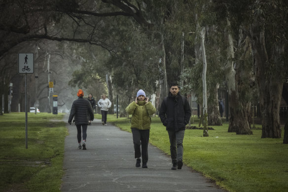
Melburnians braved the cold as the city woke to a foggy and freezing morning on Thursday.Credit: Chris Hopkins
Along the south-eastern seaboard, a slow-moving high-pressure system over Tasmania was extending a high-pressure ridge over Victoria, resulting in clear skies and light winds overnight, Efron said.
“And so that’s allowing the temperature to plummet across the state, given the absence of that cloud.”
Weatherzone’s Ben Domensino said the atmosphere above eastern Antarctica started to warm abruptly during the middle of July.
“This warming initially started in the polar stratosphere, around 30 to 40 kilometres above eastern Antarctica, but its influence has since filtered down towards the surface in the past fortnight,” he said.

Frozen park.Credit: Matt Golding
“When the air above Antarctica gets warmer than usual during winter, it can weaken and destabilise the southern hemisphere’s polar vortex. This weakening of the polar vortex causes the westerly winds that flow around Antarctica to expand towards the equator, allowing polar air masses to spread further into the mid-latitudes.”
Southern Australia can expect some marginal relief from icy temperatures over coming days, the bureau says.
Sydney is forecast to be sunny and hit 18 by the weekend. In Melbourne, showers will fall at the weekend and top temperatures of 15 are predicted.
In Perth, showers will ease by the weekend and sunny conditions will again prevail, while Hobart will remain cold and wet.
Get to the heart of what’s happening with climate change and the environment. Sign up for our fortnightly Environment newsletter.